The eastern region of Iceland has received little attention; being too far from the capital is a common observation. It’s a mistake because East Iceland has an incredibly varied landscape, featuring stunning coastlines and beautiful little fjord-side villages.
Our previous article covered all the useful information about East Iceland, including its unique weather characteristics, geology, infrastructure, recommended activities, and more. The following blog post lists the most awe-inspiring attractions we recommend you visit. Read on to learn more about both well-known and hidden gems of East Iceland!

Regions in East Iceland
East Iceland is a large region that is best divided into smaller sections:
- Southeast Iceland: The Vatnajokull Region
- The Eastfjords
- The Lagarfljót Area
- The Eastern Highlands
Southeast Iceland: The Vatnajokull Region
Vatnajokull is located in the Central Highlands, stretching to the south and east, the majority in the south. However, the area from Skaftafell to Hofn and the coastline below the Vatnajokull glacier officially belongs to East Iceland.
Vatnajökull National Park covers 14% of the total land area of Iceland. In recent years, it has become a UNESCO World Heritage site. Moreover, there are plans to extend the park into the whole of the Highland region. Once that is done, it will cover 30% of Iceland, thereby becoming one of the largest national parks in the entire world.
Vatnajökull Glacier
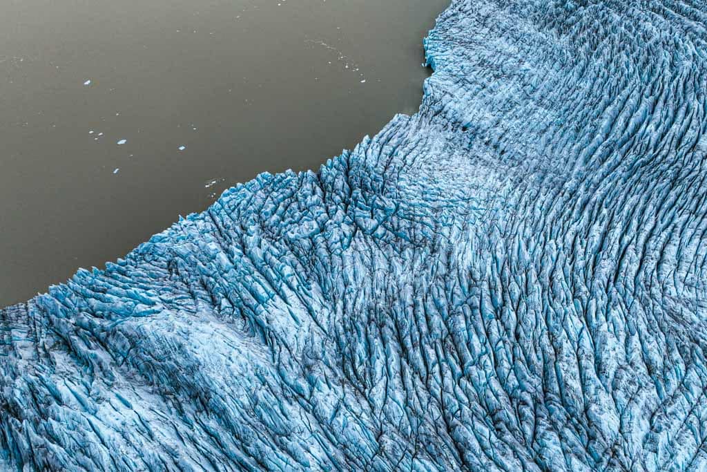
Vatnajökull Glacier, 8100 km2 (3127.4 sq. mi.) in land area, is the largest glacier mass in Europe and one of the most significant ice caps outside the two polar regions. If you want to think of it in land terms, it is three times the size of Luxembourg. The tallest mountain in Iceland, Hvannadalshnúkur, also lies beneath the ice. It is 2110 m (6922.5 ft.) high. Other mountain peaks, active volcanoes, subterranean lakes, craggy valleys, and crevasses are common features throughout the park.
You can see many of the 30 outlet glaciers that Vatnajökull sources just driving road 1 on the southeast, making fascinating settings for a perfect road trip. Expect to see thundering rivers, glistening glacial lagoons, cascading waterfalls, and many ice caves among all the natural wonders this region offers.
Jökulsarlon and Fjallsarlon Glacier Lagoons
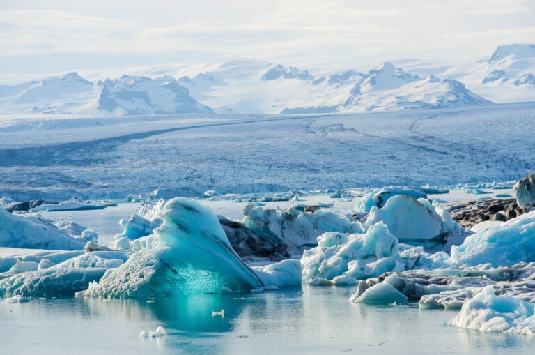
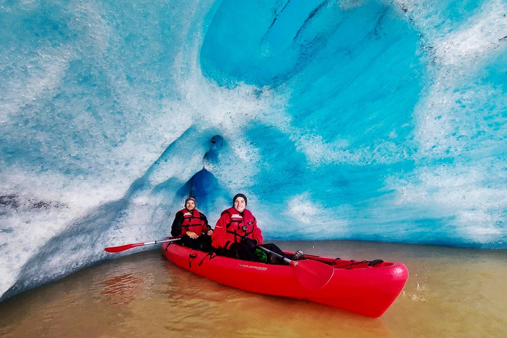
When glacier tongues reach the lowland, glacial lagoons are formed. Glaciers slowly melt and when they do, the ice retreats, leaving water to fill the depressions, hence the lakes. Large pieces of ice can break from a glacier, leaving ice floating in the lakes, a great opportunity for a photograph of something you will rarely see elsewhere. Jökulsárlón Glacier Lagoon, one of Iceland’s most popular destinations, together with another glacial lagoon, Fjallsárlón, is a short drive away, only 10 minutes.

The Diamond Beach
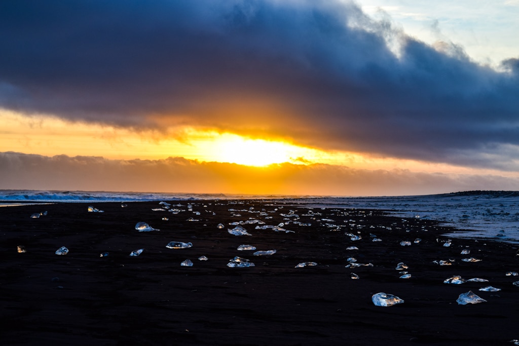
Diamond Beach is close to Jökulsárlón Glacier Lagoon. The beach takes its name from the dazzling icebergs glinting in the sunshine, rather like diamonds: pieces of the icebergs that land here from the lagoon. The contrast of the glistening ice against the black sands is absolutely breathtaking.
Numerous seals bask along the shore and the beach is a prime viewing spot for graceful orcas. It’s a fabulous destination for both landscape photographers and lovers of wildlife.
Skaftafell Nature Reserve
Skaftafell was formerly a stand-alone national park before combining with Vatnajökul National Park. It is a very popular destination for hiking, with several hiking trails to choose from. There is something for everyone here. Trails vary in both difficulty and length. In all cases, walkers can expect stunning views over the glacier, with birch forest and barren river valleys throughout the trails.
The outlet glaciers from Vatnajokull are also great places for the adventurous. Hiking, caving, and climbing are all on offer, with guides a very important element in any of these activities. It is possible to do all these activities at any time of the year, although winter might provide a real challenge. Skaftafell is the most popular tour starting point, although Hofn is also an option.

Stokknes Peninsula
Eystrahorn and the Vestrahorn Mountains
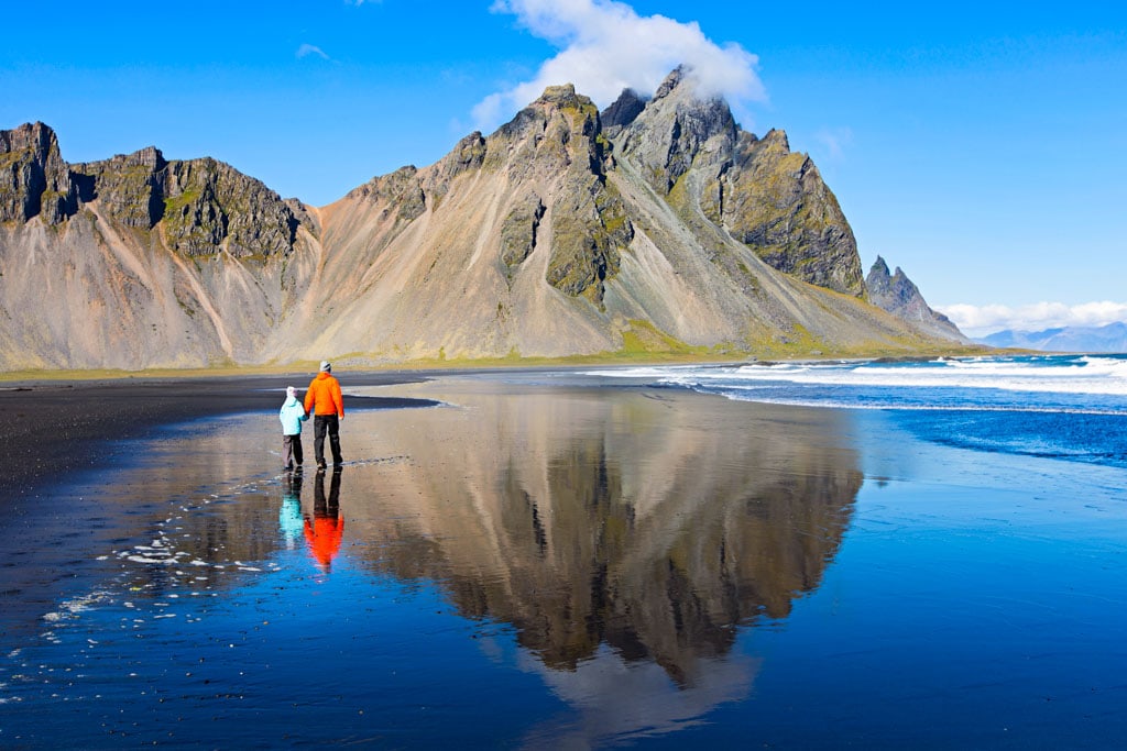
The Hvalnes peninsula is east of Höfn, no more than a 20 minutes drive from the town. You will find a lovely bay surrounded by impressive mountains. The beach comprises black volcanic pebbles and impressive sand dunes stretching for a few kilometers. On a sunny day, you will see the mountains’ image in the water so have your camera ready. If you are lucky, you may catch the reflections of the Northern Lights.
Stokksnes is often regarded as the most scenic place in the whole of Iceland. None of these mountains are above 800 meters (2600 feet), yet there is more to a setting than height.
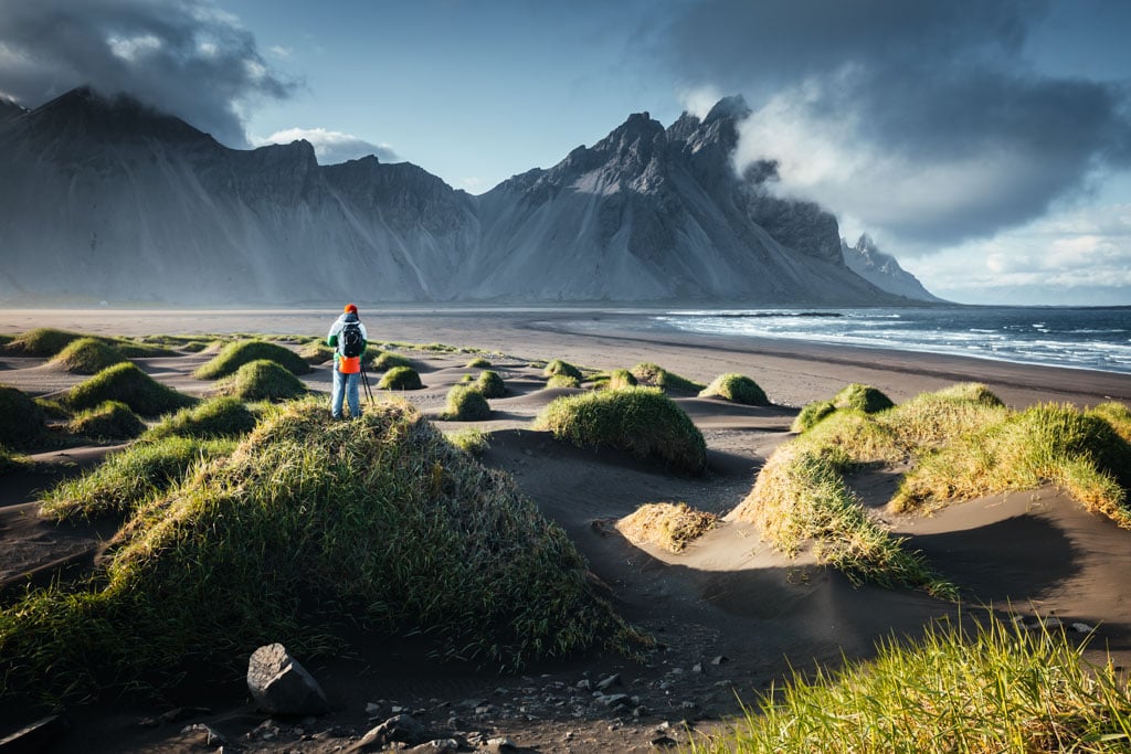
While the number of tourists visiting the peninsula is relatively low and the infrastructure for tourism is limited, it has much to offer. It is a paradise for photographers; think midnight sun, Northern Lights, and usual daytime shots.
Stokksnes Beach is private, although you will be allowed access if you pay a small fee. The owner uses the fees to help maintain the roads to and from the beach. A small cafe offers refreshments, which is where you pay your fee.
The Viking Village
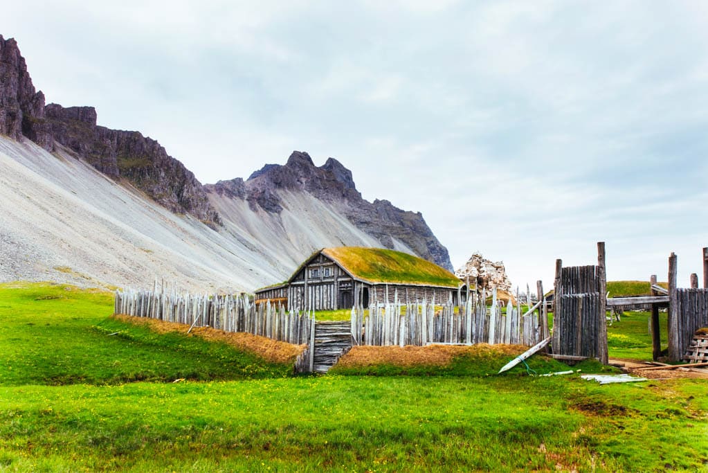
The Viking Village was originally created as a set for a movie in 2010. The film set was supposed to be used for a movie produced by Universal Studios but the filming was never finished. This unique location is located on the Stokksnes peninsula: upon passing by the Viking Café you will be able to spot the fake settlement in the distance.
The farmer’s horses graze nearby on the fields beneath the shadow of the mountain, adding extra authenticity to the surroundings. After entering the village walls, you are permitted to roam around the site at will. This offers the unique opportunity to observe the immaculate detail that goes into the creation of a film set.
The Eastfjords
You will find the Eastfjords region along the coastline from Berufjörður in the south to Borgarfjörður Eystri in the north. The dramatic shorelines are the main feature, with narrow fjords and small fishing villages within steep valleys.
All of the fjords and villages contain the letters “fjörður,” Icelandic for fjord. Each has a rich culture with art and music as part of life. Examples of the names you will find when you research this area or pay a visit are Seyðisfjörður, Fáskrúðsfjörður, and Borgarfjörður.
In the summer, Eastfjords is the hub for art and music. Art festivals continue to spring up in the area. Jóhannes Sveinsson Kjarval is one of Iceland’s most prominent artists and he hails from Borgarfjörður Eystri. A museum that celebrates his life is now there, a place where many of his most famous creations were produced.

Such is the appeal of this region, its remoteness and setting; it regularly features in movies and TV shows as well as advertisements. Examples of film and TV include “The Secret Life of Walter Mitty” and two Icelandic crime series “Trapped”, and “Stardust”.
Petra’s Stone Collection in Stöðvarfjörður
Ljósbjörg Petra María, born in a small village called Stöðvarfjörður, amassed a collection of stones starting when she was just seven years old and hasn’t stopped collecting them until her death. They are on display for visitors, a chance to see a huge variety in one place. In many ways, the collection is unique and certainly beautiful. She was fascinated by the natural world, and this fascination has expressed itself in what you can see in just an ordinary house in the village.
Effectively, her many thousands of rocks form a museum, covering the inside of her house and its backyard. Petra died in 2012 at the age of 89, but her heritage is well worth visiting. In the summertime, her home also incorporates a small cafe selling simple refreshments to tourists and visitors in the summer months.

Seyðisfjörður
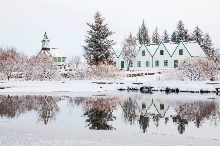
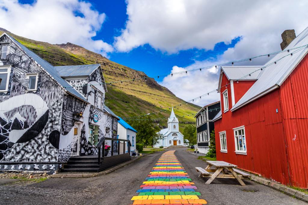
Seyðisfjörður sits at the head of the fjord of the same name. It is just a small town of fewer than 700 inhabitants, a lovely place with a colorful high street and an attractive blue church. The immediate vicinity includes mountains and many stunning waterfalls. The town relies on tourism, mainly in the summer months, and fishing. However, tourism has been increasing in recent years in Iceland, and the revenue it creates has been most welcome to the national economy.
The appeal of Seyðisfjörður has been enhanced because of the quirky style evident in the painted houses and because of the LUNGA festival. This annual event features the work of local artists. Indeed, you can see the best of all Icelandic artists if you pay a visit. This is one of the most popular such festivals in the country. Plenty of locals attend to enjoy the exhibitions and art workshops. In addition, there are fashion shows and concerts which tourists and locals enjoy.
It is fairly easy for overseas visitors to reach Seyðisfjörður because there are regular ferries to Scandinavia. As a result, plenty of tourists begin their holiday in Iceland in this small town.
Borgarfjörður Eystri
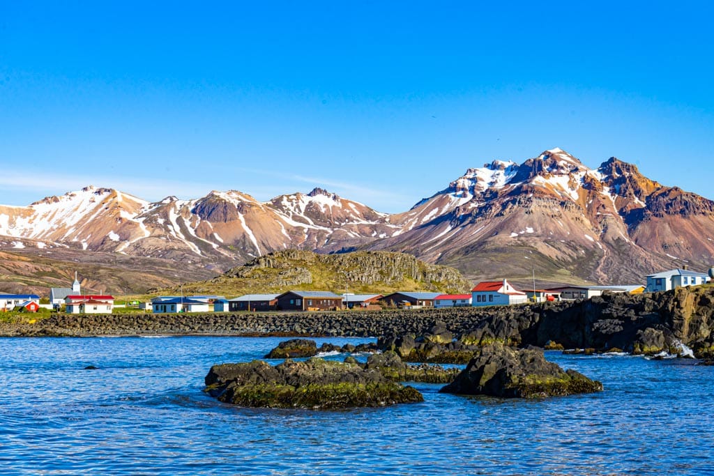
Only 130 people live in Borgarfjörður Eystri, a little town whose primary activity is fishing. However, the hiking trails that start here have increased tourist activity, both from Icelanders from other parts of the country and overseas visitors keen on hiking.
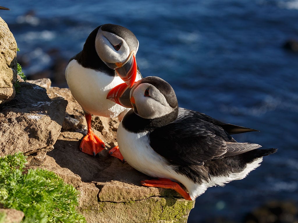
The setting is a town surrounded by mountains, rhyolite ones to the south and basalt ones to the north. The area is one of the best places in Iceland for watching puffins: in the nesting season, some 10,000 pairs of puffins raise their chicks.
Access to the nesting area is via boardwalks at Hafnarholmi Marina. Still, you cannot get too close, thereby disturbing the birds. The nesting season starts in May and continues to August when the puffins begin to disperse, often heading out to sea to fish.
Borgarfjörður Eystri is also known for its legends. It is said that the elf queen lives here in a large rocky outcrop on the outskirts of the town. Álfaborg is its name, translated into elf rock or elf castle. Locals tell the story of the elf queen to visitors, advising them to head to the castle rock outcrop, even for a short time. If they pay their respects, the elf queen will bestow good luck and fortune on them.
Dyrfjöll (“Door Mountain”) area and Stórurð
Dyrfjöll is part of a large mountain range close to the Borgarfjörður Eystri. This stunning mountain range is something you must see as you travel within East Iceland. The Dyrfjöll stands out because of its unique shape, and you will understand this if you travel around the island and see the other mountains on view.
Steep vertical walls feature within the mountain ranges. The result is a shape similar to a conifer tree, tall and pointed. You may be lost for words when you see such beauty but don’t lose your camera because your photos will likely stun your friends when you return home.
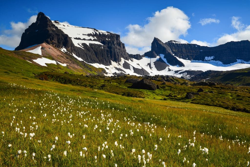
The name of the mountains comes from the Icelandic word for “door.” dyr. That is because of the large gap you will see. The highest peak is 1,136 meters (3,727 feet) incidentally. These are volcanic mountains formed in two main silicic phases of activity. The result is a whole series of calderas visible throughout the volcanic field.
Stórurð, below Dyrfjöll, is certainly one of East Iceland’s special places. You will see plenty of big tuff boulders, meadows, and beautiful blue ponds. It is a challenge to hike in Dyrfjöll unless you are experienced, yet the experience is very rewarding.
The Lagarfljót Area
The biggest lake in East Iceland is called Lagarfljót. Its location is inland, far from the coast, measuring 5 km (3.2 miles) long and 2.5 km (1.6 mi.) wide, and 112 meters (367 ft.) deep.
Local legend says that a serpent called Lagarfljótsormurinn lives in the deep. A video taken in 2012 claims to have captured the serpent on film. The video went viral on youtube, and you can judge its accuracy for yourself by going to this link:
The first sightings of the Lagarfjlót serpent were in the middle of the 14th Century. Word of mouth carried those stories, and others, down through the ages. Descriptions of these sightings vary from describing the creatures as a snake, a giant seal, a dragon, or a giant worm.
New photos and videos come out regularly. They each show a strange form on the surface of the lake. Several of these sightings claim that this is indeed the serpent, and many more have been proven to be just logs, currents, the wind, or slabs of ice. However, as if to keep the story of the serpent going, there are some sightings that even experts can’t explain.
Egilsstadir Town
Lagarfljót is close to Egilsstaðir, the east’s capital, so if you visit the region, you are certain to see the lake. Around 2500 people live in Egilsstaðir, the largest settlement in the area. As a result, it is also the commercial hub of the region. You can find lovely accommodation in the town, plenty of it being on the shores of the lake. You do not have to travel by road to get here; there are daily domestic flights from Reykjavík to Egilsstaðir.

Stuðlagil Canyon
Another natural attraction close to Egilsstadir is Stuðlagil Canyon. It provides stunning images regularly appearing on social media and in promotional material for East Iceland. Basalt columns stand on the edge of the blue water, an absolutely beautiful setting!
The canyon has been hidden because it is underwater. It forms part of a larger canyon, Jökla’s canyon in Jökuldalur valley Glacier’s Valley is its more popularly used name Kárahnjúkavirkjun, a large hydroelectric plant sits on the river. The result is a significant reduction in the flow of the river, and this has led to the hidden canyon being increasingly revealed as the water level drops.
If you want to see nature’s perfection, Stuðlagil is a fine example because every feature in the setting is wonderful, arguably as good as it gets. There is more to this area than its setting. There are plenty of opportunities for an adrenaline rush when you visit if you are adventurous.
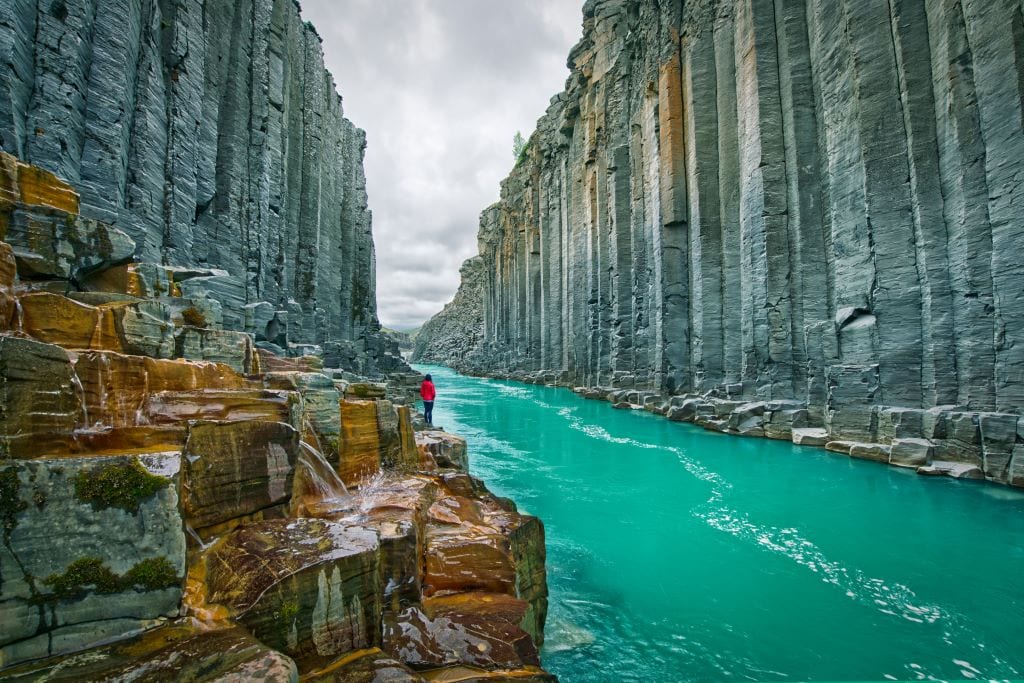
After a period of significant rain, the waters that you see will likely turn brown. That is because they will have gathered a great deal of silt from the bottom. It is not advisable to go into the canyon at such times because the water level and the speed of the current can change.
Vök Baths
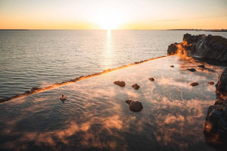
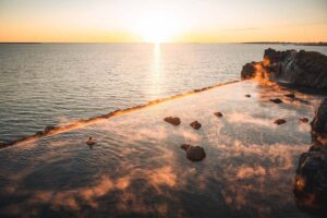
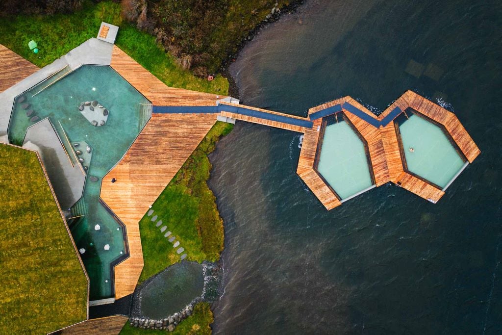
East Iceland’s biggest sauna and spa are Vök Baths on the shores of Lake Urriðavatn. The Baths are very popular with locals and foreign visitors alike. An open bath is found on the shoreline together with two huge pools floating on the lake itself.
As if these pools were not enough, there is also a pool bar at one of the pools and a tea bar where you can sample tisane tea using local ingredients. You will find everything you need to enjoy the day; showers, changing rooms, rental swimsuits if needed and a receptionist answering queries.
Hallormsstadaskogur Forest
There are not a whole load of trees in Iceland. As more and more settlements were built in Iceland, more and more trees were cut down for housing without there being a plan to plant new ones. Add to that the fishing industry requiring boats and even more timber was needed. Although it is only a guess, it is thought that significant tree cover had disappeared within a century of the island being settled.
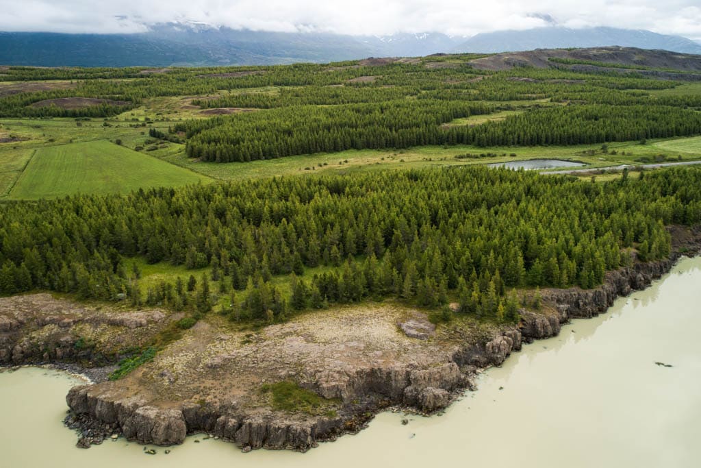
Soil erosion followed and that merely added to the problem. The result is that visitors are likely to see vast areas of volcanic rock, largely bare. However, Hallormsstaðaskógur, a birchwood forest, got government protection in 1905. It was the first time the government had given protection to a forest., covering 740 km2 (286 sq. miles). There are 85 different species in the forest, some being native ones. The vast majority however have been introduced from elsewhere in the world.
Hengifoss and Litlenasfoss waterfalls
There is something really special about waterfalls, and there are several great examples in Iceland. Hengifoss is the third-highest waterfall in Iceland, with a 128-meter (420 feet) drop. It stands out from others because of the black and red basalt rock wall behind the cascading water. The red color within the rock wall results from the clay formed between the basaltic strata. The layers of clay are called “Paleosols” by soil scientists.
If you travel by car, you will have a 2.5 kilometer (1.6 mile) hike after parking your car. You must therefore go properly equipped with warm clothing and comfortable footwear, the latter every time, the former depending on the season. It will take you around an hour to complete the uphill hike. You should plan accordingly because you will need time once you arrive to really appreciate the setting in front of your eyes. Hengifoss should definitely be on your list of things to see in Iceland.

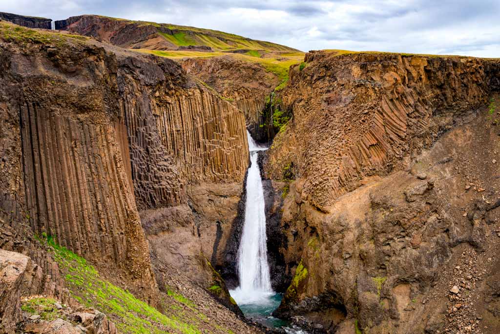
A much smaller waterfall is near Hengifoss just 35 meters (115 feet) high. Litlanesfoss is its name, but it is often called Stuðlabergsfoss instead. The distinctive feature of this waterfall is the hexagonal basalt columns surrounding it. If you take a hike along the Hengifossá River, you will see both of them as you walk.
The Eastern Highlands
The Icelandic Highlands are the interior of the islands. Geographers describe such regions as tundra. This wilderness covering the majority of Iceland is entirely uninhabited and it is where you will find many of the island’s natural highlights. Impressive, yes, and certainly very inaccessible. The eastern section of the Highlands is where you will find some of the best volcanoes and mountains in Iceland: Askja, Snaefell, and Herdubreid.
Askja Crater and Víti Crater Lake
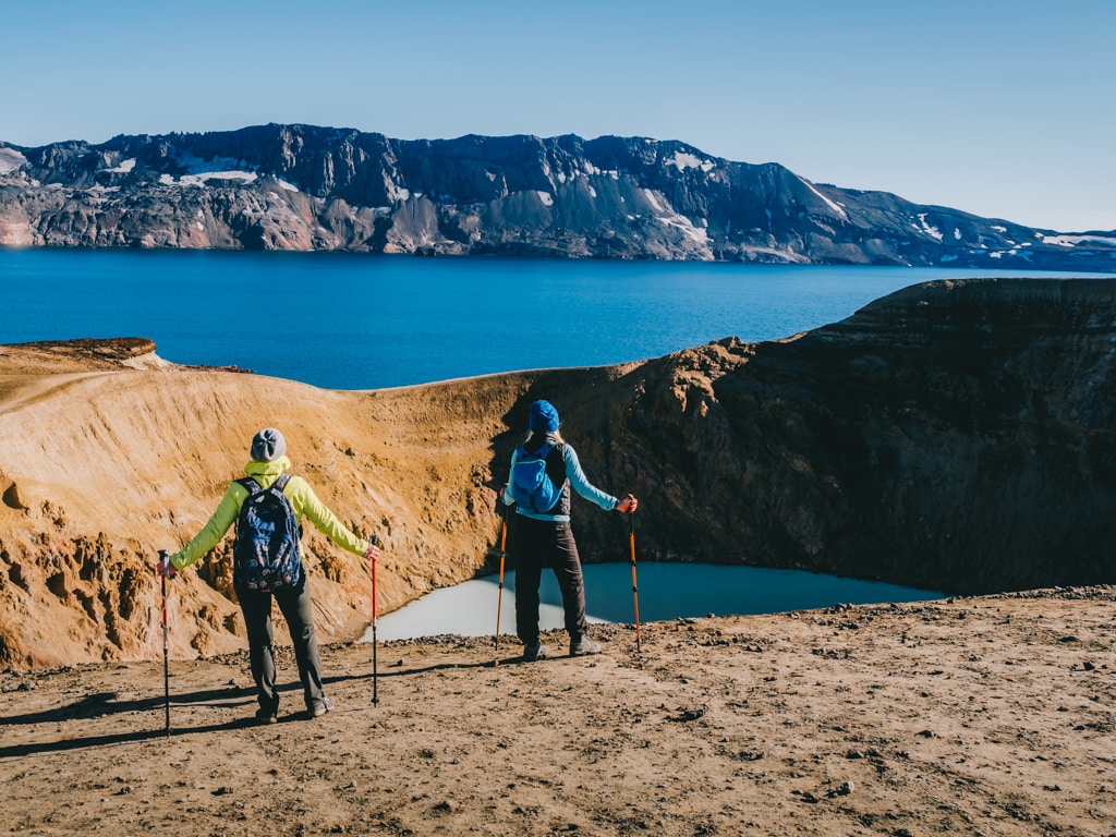
Askja is a caldera measuring 50 km3 (31 cu. miles) within the Dyngufjöll mountains. Askja dates back to a huge eruption towards the end of the Ice Age. Within the caldera, there are a few craters and volcanoes. Viti, in Icelandic meaning “hell”, is the most famous, a crater filled with water whose constant temperature remains at about 30°C (86ºF). The surroundings are much like moonscapes, something that doesn’t seemingly belong in this world.
Herdubreid Mountain
This mountain is close to Askja, amid the largest lava field in Iceland, Odadahraun. At 1682 meters (5518 feet.), Herdubreid is regularly referred to as the “queen of Icelandic mountains.” A poll in 2002 suggested it should be the national mountain of Iceland, and that title has stuck.
In years gone by, many criminals and others shunned by society used to gather at the foot of the mountain near an oasis.

Laugarvellir Hot Natural Waterfall
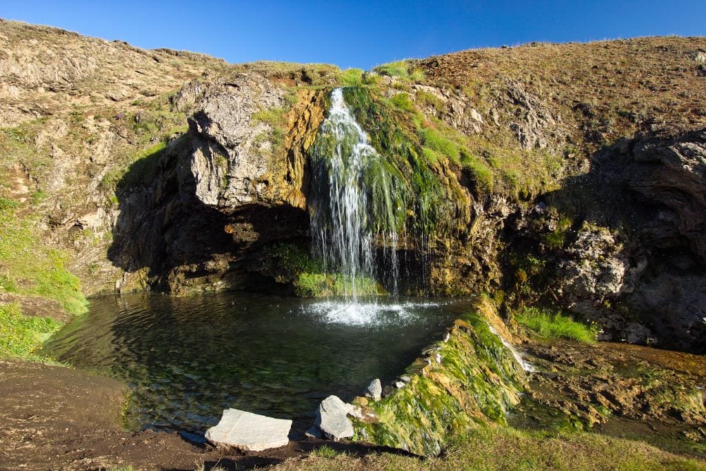
If you head to the northeast within the Central Highlands, you will get to Laugarvellir, comprising a geothermal pool, waterfall, and valley. This is a remote region, but your reward is the chance for a long soak in a pool whose temperature range is between 39C and 41C. It would be best to put a finger in to test the heat before jumping in.
The geothermal pool is at a fairly high altitude within the Central Highlands. That altitude is 600 meters, with the lush vegetation surrounding the pool partly due to the altitude. Few natural settings are more beautiful than here.
You can only expect to reach here in summer, and then only with a 4×4, that can navigate the gravel roads.
Our article has covered the most beautiful sites to visit in East Iceland. In this separate article, you can read useful information, interesting facts, and exciting activities regarding East Iceland. Contact us for your tailor-made vacation package, and a local professional will personally help you to plan your perfect East Iceland holiday.

