Although located fairly close to the Icelandic capital, the beautiful Snaefellsnes Peninsula sees relatively few tourists. As well as being full of scenic splendor, the area offers amazing chances to escape the tried-and-trodden track, escape the crowds, and discover some of Iceland’s gorgeous remote countryside.
A road goes all around the peninsula, and it’s possible to complete the route in just one day. Just the name Snaefellsnes, which means Snow Mountain Peninsula, evokes images of wonder. Indeed, it’s named after one of the area’s main attractions: a wondrous conical volcano topped with a glistening glacier. A trip includes many kinds of natural gems, from black-sand beaches and volcanoes to waterfalls and glaciers.
Sounds great, right? Now, we’ll take you through the most awesome places to visit around the Snaefellsnes Peninsula and let you into a few hidden gems to consider adding to your bucket list too.
- How to get to the Snaefellsnes Peninsula?
- Must-see attractions on the Snaefellsnes Peninsula
- Eldborg Crater
- Gerðuberg Basalt Cliffs
- Ytri Tunga Beach
- Búðir Church
- Bjarnafoss Waterfall
- Rauðfeldsgjá Ravine
- Hellnar
- Arnarstapi
- Lóndrangar Basalt Cliffs
- Vatnshellir Cave
- Djupalonssandur Black Beach
- Dritvík Cove
- Snæfellsjökull National Park
- Snaefellsjökull Glacier
- The Svörtuloft Lighthouse
- Hellissandur Village
- Ólafsvík
- Kirkjufell: The “Church Mountain” and the Kirkjufellsfoss waterfall
- Grundarfjörður Village
- Berserkjahraun Lava Field
- Stykkishólmur
- Breiðafjörður fjord
How to get to the Snaefellsnes Peninsula?
The 90-km-long (56-mile-long) peninsula is located in West Iceland. It lies around 150 km (93 miles) north of Reykjavik. It’s one of the most scenic and exciting destinations in the western part of the country, and the peninsula is home to one of Iceland’s three national parks.
You can explore the peninsula independently in a rental vehicle or join a guided tour. Each option promises plenty of fun. Read our article on different ways to travel around Iceland to help you decide which traveling style suits you best.
Self-Drive Tours
The gorgeous Snaefellsnes is easy to discover by rental car. If you’re planning to drive around the peninsula independently, head north on Road 1 (the Ring Road) from Reykjavík. Switch to Road 54 when you reach Borgarnes, and follow that road until you reach the peninsula. There’s just one road that loops around the peninsula, so it’s all but impossible to lose your way.
It takes around two hours to reach Snaefellsnes from the capital, though to enjoy the area’s many treasures, you should allocate a full day (around 10 to 12 hours) to hit the highlights and make the most of your excursion. If you visit during the winter months, when the days are shorter, it’s better to stay overnight and split your trip between two days.
Do note that Snaefellsnes can be rather windy in the winter, and the roads can be icy and/or have snow. The driving conditions can be challenging at this time of year. People who aren’t experienced in driving in wintry conditions are advised to join a tour.

Public Transportation
It isn’t easy to use public transport to visit the Snaefellsnes Peninsula. There’s only one direct bus from Reykjavik to Stykkisholmur, which only runs three times per week. The bus doesn’t connect with any of the peninsula’s attractions; you must take taxis to reach the natural gems. Practically, the best ways to explore the peninsula are by group tour or with your own rental car.
Must-see attractions on the Snaefellsnes Peninsula
Now that we’ve covered how to get to the Snaefellsnes Peninsula, these are the top places to add to your itinerary:
Eldborg Crater
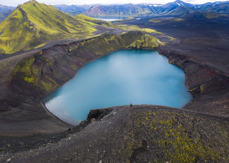
Beginning on the peninsula’s southern edge, you’ll spot the magnificent Eldborg Crater from the road. Take a brief detour from Road 54 to reach the crater.
Known as the Fortress of Fire, Eldborg Crater is a massive and imposing volcanic crater that towers 60 meters (197 feet) over the surrounding lava field. The diameter is a whopping 200 meters (656 feet). You can follow the hiking route around the crater; the walk is around 6 km (3.7 miles) long, and it’ll take around two hours to complete the climb up the volcano and to encircle the crater.
Don’t worry about any nasty surprises; the volcano last erupted some 6,000 years ago!

Gerðuberg Basalt Cliffs
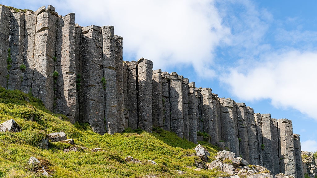
A huge wall of gigantic hexagonal basalt columns is the crowning jewel of the attractive Gerduberg nature reserve. The enormous columns tower up to 15 meters (9 feet) high, and the perfectly formed geometric patterns stretch for some 500 meters (1,640 feet). It’s definitely one of the most spectacular column formations in all of Iceland.
Gerduberg is easy to reach from Road 54, and it’s just a short walk to the cliff from the car park. Follow the walking path in front of the massive columns before enjoying the views from the top.
Ytri Tunga Beach
The golden sands of Ytri Tunga Beach can be admired on an old farm along the peninsula’s south coast. As well as being a pleasant beach, it’s one of the best places in the country to spot wild seals during the summer months.
You’re all but certain to see grey and calf seals. Read the signs in the parking area to learn more about the common seal species that can be viewed here, along with details on distinguishing the different types of seals. Take binoculars for the best views.

Búðir Church
The small coastal hamlet of Búðir was once a bustling fishing village and among the busiest trading posts along the Snaefellsnes Peninsula. Inhabited for a long time, the area was abandoned at the beginning of the 19th century.
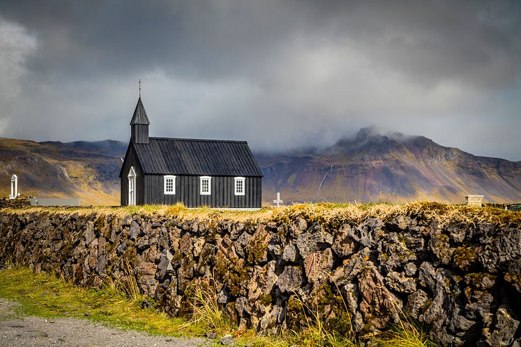
Today’s visitors will find a handful of buildings surrounded by a stretching lava field. The main reason to visit nowadays is to see the small but beautiful black church of Búðarkirkja. Sitting on the site of an older church from the early 1700s, the present religious building dates back to 1848 (with renovations in the 1980s.) The dark paintwork, plus the dramatic setting, makes it a popular spot for photography. The nearby luxury hotel is a top spot for weddings too.
Bjarnafoss Waterfall
The picturesque Bjarnafoss Waterfall tumbles down the jagged mountains along the peninsula’s southern coast. You’ll spot the mists rising in the distance before you actually reach the cascades. It may not be one of the most well-known falls in Iceland, but it’s a beautiful sight with a pleasant walking route.

Rauðfeldsgjá Ravine
Located in the south of the peninsula and known in English as the Red-Cloak Rift, Rauðfeldsgjá is a dramatic gorge with a pretty stream running right through it.
To reach the ravine, follow Road 674 towards Hellnar from Road 54. You really can’t miss the gigantic crack in the mountain face coming out of Snæfellsjökull Glacier. After parking, it’ll take around 20 minutes to walk to the bottom of the gorge. It’s then possible to follow the glacial meltwater stream and climb inside the chasm. You can also walk to the ravine’s edge for a fabulous view.
A short climb leads to a small waterfall. However, if anyone wants to explore the gorge further than the cascades, sturdy footwear and waterproof clothing are necessary. You’ll also need a reasonable fitness level and be willing to get wet! Warning: the route is not safe when it’s icy.

Hellnar
Continuing west from Rauðfeldsgjá Ravine along Road 674, you’ll reach the old fishing village of Hellnar. Once one of the biggest fishing stations on the Snaefellsnes Peninsula, written records of maritime activity date back to 1560.
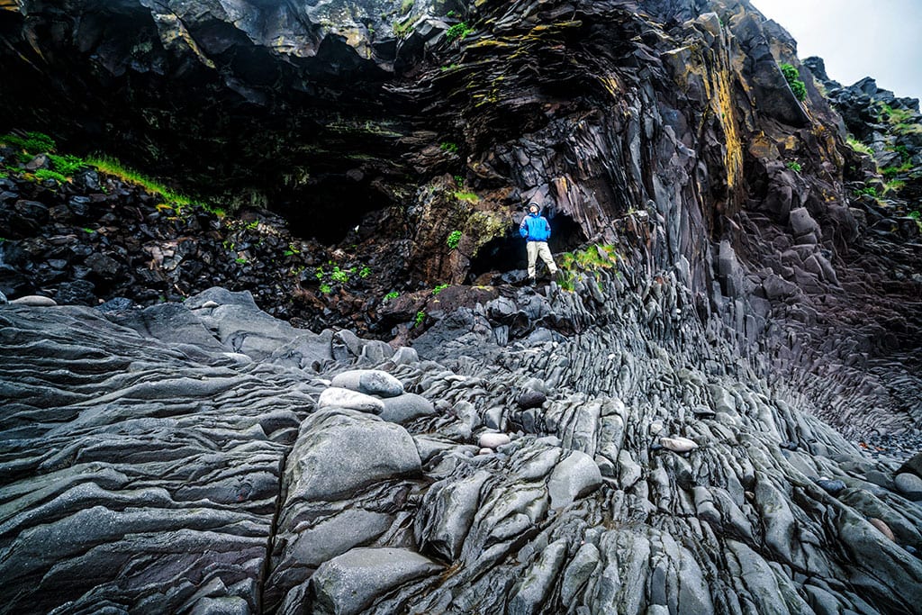
Gorgeous rock formations line the shores of Hellnar, formed by volcanic activity and subsequent waves crashing against the land and breaking up the brittle lava. The most stunning formation is the jagged cliff of Valasnös. Tunneling into the cliffside, the colors seem to change depending on the weather, time of day, and sea conditions.
Arnarstapi
The small settlement of Arnarstapi is next to the pyramid-shaped mountain of Stapafell. Once a significant trading post with many more people, it has a few homes, a small pier, and an information office. You can also see the exciting sculpture of Bárður Snæfellsás by the artist Ragnar Kjartansson.
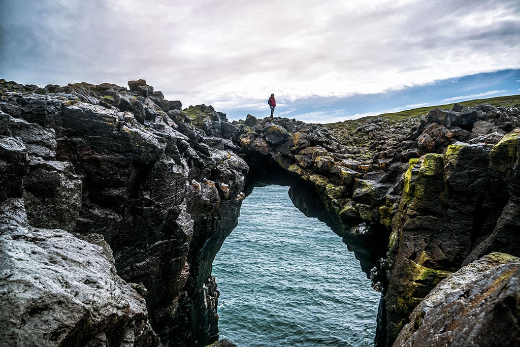
There are striking rock formations throughout the area, the most famous being Gatklettur. Known in English as Hole Rock, you’ll quickly see where it gets its name; a huge hole cuts through the rock, providing splendid views of the sea and the waves.
Feast your eyes on scenic views and soak up the tranquil ambiance. You can also see the colony of Arctic Terns and other seabirds that live along the coast.
Lóndrangar Basalt Cliffs
The Lóndrangar Basalt Cliffs are made up of impressive twin sea stacks that tower 61 meters (200 feet) and 75 meters (246 feet) over the ocean. The stunning stacks create the appearance of a majestic coastal fortress. Steeped in local legends and lore, it’s said that the cliffs are home to elves and trolls. Several species of aquatic birds live in the clifftops, for example, fulmars and puffins.
Head to the viewpoint to admire the sweeping views over the basalt sea stacks and the rocky coastline. (There’s a parking area close by for convenience.) If you want to get even closer to the pillars, follow the hiking trail from the car park near the lighthouse.

Vatnshellir Cave
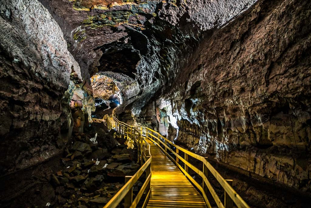
One of the major attractions in Snaefellsjökull National Park, the interesting Vatnshellir Cave, is an 8000-year-old lava tube. The cave is a short drive (around ten minutes) from Hellnar.
Running for more than 200 meters (656 feet), the cave goes as far as 35 meters (115 feet) deep. There are two main sections: upper and lower. Each is filled with unusual lava formations and vibrant volcanic rocks.
Join a 45-minute-long guided tour to appreciate the cavern’s beauty and size fully. It’s easy to walk along the path, and it’s high enough to walk all the way without any need to crawl. You’ll be provided with all necessary safety equipment before the tour begins, though you should wear sturdy closed-toe shoes to manage the uneven ground.
Djupalonssandur Black Beach
Although southern Iceland’s Reynisfjara is one of the country’s most famous black sand beaches, Djúpalónssandur Beach is equally as beautiful and dramatic. Djúpalónssandur means Deep Lagoon Beach, though the nearby lagoon is only actually five meters (16.4 feet) deep! Black sand and smooth pebbles cover the ground, and photo opportunities abound.
As you explore the stunning coastline, you can also see a shipwreck: the Epine GY7. The British trawler met its sad fate in 1948 when the boat was wrecked, and 14 men lost their lives. The remains serve as a memorial to those who perished in the disaster.
Warning: take care not to venture too close to the raging waves. The ocean can, and does, suddenly sweep people out to sea.

Dritvík Cove
Follow the beach from Djupalonssandur, and you’ll reach the scenic Dritvík Cove. A hiking trail leads above the cove, providing terrific views across the area.
Once upon a time, Dritvík was one of Iceland’s biggest fishing stations. For hundreds of years, the area thrived with fishing boats and huts. From the 16th century, some 400 people lived here during the fishing season. The fishing industry here wound down in the early 1900s. Few signs of former homes remain today. Fishermen constructed temporary huts from stacked stones covered with fabric, little of which survived to the present day.

Snæfellsjökull National Park
Snæfellsjökull National Park is the middle, size-wise, of Iceland’s three national parks. It encircles the majestic Snæfellsjökull Glacier and Volcano and reaches the coast. It’s the country’s only such national park.
Covering 170 square kilometers (65.6 square miles), the national park is home to several natural splendors, including the mighty Snæfellsjökull. On a clear day, it’s possible to see the striking cone-shaped volcano from Reykjavik, which is 120 kilometers / 75 miles away!
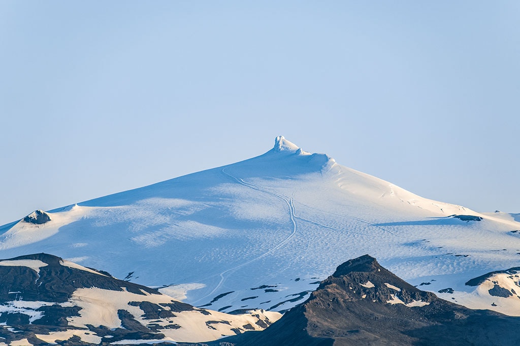
Standing 1,446 meters (4,744 feet) tall, the magnificent glacier sits atop an ancient stratovolcano. The volcano dates back around 700,000 years! Over the years, the glacier is gradually shrinking; the 12-km-squared (4.6-mile-squared) glacier is now around 3 square kilometers (1.2 square miles) smaller than it was at the start of the 20th century. Furthermore, there was no ice on the peak in 2012, the first time ever throughout recorded history. Indeed, the glacier may no longer exist in years to come. Visitors now flock to see this piece of disappearing history.
The national park is also rich in folklore and legends. Learn more about, for example, Bárður Snæfellsás, a man-troll after whom many of the park’s attractions are named. The glacier has also been featured in several literary works, including Journey to the Centre of the Earth by Jules Verne and Kristnihald undir Jökli (Under the Glacier) by Halldór Laxness, a Nobel Prize winner from Iceland.

Snaefellsjökull Glacier
Within Snæfellsjökull National Park, Snaefellsjökull Glacier is the star attraction in West Iceland. Visible from near and far, the behemoth is some 700 millennia old! It last erupted in around the year 200 AD. Expert guides lead climbing and hiking expeditions for those who want to experience the area’s raw beauty safely.
The name comes from a combination of Snæfell (Snowy Mountain) and jökull (Glacier). There are people who believe that the area is the Earth’s heart chakra; the site is said to have a special energy field. It’s definitely a wondrous place!
The Svörtuloft Lighthouse
You can get to Svörtuloft Lighthouse by turning left onto Road 579 from Road 574 at the peninsula’s tip. At the end of Road 579, head south to a car park.
Built in 1931 to replace an older structure, Svörtuloft Lighthouse is more than 12 meters (39.4 feet) tall. The striking lighthouse is perched over a long stretch of black lava cliffs. The colorful lighthouse contrasts with the dark landscapes, and it’s an ideal place for avid photographers.

Hellissandur Village
The small fishing village of Hellissandur is located on the northern edge of the Snaefellsnes Peninsula. Indeed, it’s the first major settlement people reach if visiting the peninsula from Iceland’s capital city.
Once a major center for fishing, you can learn more about the village’s fishing and seafaring heritage at the Maritime Museum. One of the most exciting exhibits is the oldest rowing boat in the country, which was built in the 1820s. Another top local site is Sjómannagardur, or the Fishermen’s Garden, which is home to small renovated traditional turf dwellings.
Gaze up at the 412-meter-tall (1,351-foot-tall) radio mast, once one of Europe’s tallest radio masts.
Today the village is also known as a haven for birdlife. Arctic terns nest here and you’ll likely spot many aquatic birds as you wander around.

Ólafsvík
Located near the Snæfellsjokull Glacier, Ólafsvík is a quaint fishing village on the peninsula’s north coast. Established in the 1680s, Ólafsvík is the nation’s oldest trading town. More than a thousand people call the village home today, and there is still a large harbor and an active fishing industry.
Brimming with history, a walk around the village promises to yield many pleasant surprises. You can top into a local eatery to sample the freshest catch or cool off with a refreshing dip in the nearby Bæjarfoss pool.

Kirkjufell: The “Church Mountain” and the Kirkjufellsfoss waterfall
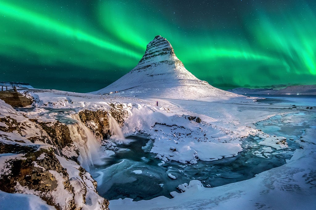
Kirkjufell, AKA Church Mountain, is one of the most iconic landmarks across Iceland. Often used for marketing campaigns, on postcards, and in the pages of glossy travel magazines, the stunning mountain rises more than 460 meters (1,509 feet) into the sky.
In the unlikely event you haven’t already seen gorgeous images of the mountain, you may still have a sense of deja vu—Kirkjufell was a major filming location during season 7 of the popular TV show Game of Thrones. You might recognize the mountain as Beyond the Wall.
One of the most photographed mountains in the whole country, you’re sure also to want to get your own stunning snaps. Whether you visit in the summer when the mountain is bathed in light at all hours of the day and night or in the winter months when the striking Northern Lights dance across the skies, you won’t be disappointed.
For even more outdoor fun, follow the walking trail from the carpark to a viewing point where you can admire two waterfalls perfectly positioned in front of the dramatic mountain.
Grundarfjörður Village
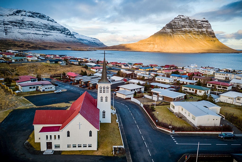
Next to Kirkjufell, the small village of Grundafjörður is also worth a quick stop. Home to around 900 inhabitants, the village provides even more striking Insta-worthy views of the famous mountain.
It’s not just great for the views, though; the village is a terrific destination for lovers of outdoor activities like hiking, kayaking, and golfing. Fancy a longer stay? You’ll find a few small eateries and cozy guesthouses too.
The village has a claim to fame, too: it was a filming location for several movies, including the 2013 Ben Stiller hit, The Secret Life of Walter Mitty.
Berserkjahraun Lava Field
Sandwiched between the nearby villages of Grundarfjörður and Stykkisholmur, Berserkjahraun is a must-visit natural site; it’s the most stunning lava field on the whole peninsula. The dramatic landscapes were created during a volcanic eruption around three to four millennia ago.
Two large and gaping craters loom over the lava fields: Rauðkúla (the Red Crater) and Grákúla (the Grey Crater). Despite the names, both craters are actually red in color. Greyish-colored moss, however, coats the slope of one.
The area takes its name from a tale in the well-known Icelandic saga of Eyrbyggja. Way back in the 10th century, according to the story, a local farmer employed two Swedish laborers. Often referred to as Berserkers, the men were notorious for being big and belligerent. One of the men wanted to marry the farmer’s daughter. The farmer was afraid to refuse, so he sought advice from the local chieftain. The chieftain suggested setting an impossible task. The farmer subsequently told the man to create a road through the lava field and upon completion, he could marry his daughter.
To the farmer’s disbelief, the man quickly performed the task. When the road was almost complete, the farmer invited the two men to relax in a sauna. He had ulterior motives, though. Still not wanting the Swedish man to marry his daughter, he murdered both men and buried their bodies to hide his crime.
Although told as a legend, a road still runs across the lava field. Even eerier recent excavations uncovered the remains of two large men …

Stykkishólmur
Stykkishólmur is the biggest town on the peninsula, with a population of around 1,100. Today a charming fishing town, it was originally established around a natural harbor by Danish and Norwegian merchants. A ferry runs across the bay, connecting the town with Flatey Island and the Westfjords.
Stroll around and admire the vibrant buildings from the end of the 1800s. Call the Volcano Museum for a lesson on physical geography, sample delectable shellfish in one of the inviting eateries, pause for a break in a welcoming cafe, and learn more about the local way of life and culture. You can also enjoy the scenic vistas of the surrounding landscapes across Breiðarfjörður Bay.
Breiðafjörður fjord
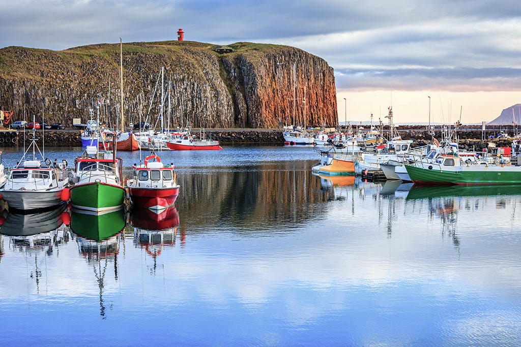
The Breiðafjörður fjord, found in the northern part of the Snaefellsnes Peninsula, is the second-largest fjord in Iceland. Its dimensions are impressive, around 70 kilometers (43.5 miles) at its widest and 125 kilometers (almost 78 miles) at its longest. It separates the Westfjords from the remainder of Iceland.

The ferry called “Baldur” crosses this fjord all year round between Stykkisholmur to the south and Brjánslækur to the north. In the summertime, the ferry stops at Flatey island. If you want to explore the bay and islands, the ferry allows you to do that.
The northern part of the bay is thought to have been formed around 15 million years ago, making it twice the age of the southern end of the fjord. It is relatively shallow in most places, with as many as 3000 little islets throughout the bay. Their formation was a result of glacial activity during the ice age.
Flatey island
Many of the larger islands were formerly inhabited, with the island of Flatey even having a monastery. That is no longer the case as most have no population and have been abandoned other than Flatey, the only one in Breiðafjörður where people live all year round.
Without permanent residents, these islands allow rich flora and fauna to develop. You will be able to see big puffin colonies in the summertime, with as many as 50 bird species making them home. Those species include brent geese, eider ducks, and black guillemots, but the real highlight that you can see is the white-tailed eagle. Marine life includes shoals of herring and plenty of other fish and shellfish. With these waters full of food, you can expect to see different species of whales, such as minke, humpback, and even orcas (killer whales), as well as dolphins and porpoises.
The wonderfully varied landscape of West Iceland offers visitors countless attractions to explore. Read our articles on West Iceland and other regions: the Reykjanes peninsula, the Silver Circle, and The Golden Circle,

